650 Gimbal Models - Worldwide Shipping - Live Support

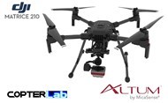
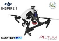
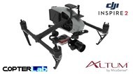
Micasense Altum NDVI Integration Mount Kit for DJI Inspire 2
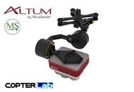
Micasense Altum
Micasense Altum – the latest sensor from Micasense has set a new benchmark in agricultural drone technology. Now you can simultaneously capture thermal imagery as well as high resolution multispectral data. The resolution of the RedEdge M at 80m AGL set an industry standard, you can now fly higher with the Altum and get the same resolution. This means you have a bigger “swath” or effectively less overlap and more area covered per flight. Five high-resolution lenses mean you get detailed plant health imagery (4 cm GSD) and detailed Digital Surface Models all from 120m.
Altum integrates a radiometric thermal camera with five high-resolution narrow bands, producing advanced thermal, multispectral and high-resolution imagery all in one flight for advanced analytics.
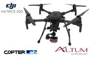
A plug and play integration right out of the box, Altum is available with the DJI SkyPort, enabling seamless integration with the DJI Matrice 200 series professional drones. The price for the Micasense Altum with Skyport is $23,000 inc GST.
As with the Micasense Rededge M, the Altum includes MicaSense’s five-band configuration of multispectral bands. These bands are: red, green, blue, near-infrared and red-edge and also includes an integrated FLIR thermal sensor. This provides temperature measurement for every pixel of data collected for crop health optimization. You can process data from the Micasense Altum with industry standard software like Agisoft, Pix4D or Solvi to generate an aligned, radiometrically and calibrated six band geotiff.
Micasense Altum Specifications:
| Weight: | Altum + DLS 2: 406.5 g Altum: 357 g DLS2: 49 g Wi-Fi Adapter: 2 g USB stick: 9 g |
| Dimensions: | 8.2 cm x 6.7 cm x 6.45 cm |
| External Power: | 4.9 – 25.2 V |
| Power Input: | 5.5/7.0/10W (standby, average, peak) |
| Spectral Bands: | Blue, Green, Red, Red Edge, Near Infrared (NIR) |
| RGB Color Output: | High-resolution, global shutter, aligned with all bands |
| Thermal: | LWIR thermal infrared 8-14um. Radiometrically calibrated |
| Sensor Resolution: | 2064 x 1544 (3.2 MP per EO band) at 120m (AGL 81cm per pixel (thermal) at 120m |
| Capture Rate: | 1 capture per second (all bands), 12-bit RAW |
| Interfaces: | Aircraft: Trigger input, top of frame out, 1 PPS out. 3.3V isolated IO 2x USB 3.0 SuperSpeed ports for WiFi or Ethernet and USB 3.0 Storage |
| Field of View: | 48° x 37° (multispectral) 57° x 44° (thermal) |
| Focal Length: | 8 mm (multispectral) 1.77 mm (thermal) |
| Storage: | USB 3.0 compatible storage devices |
Altum kit comes with: Micasense Altum sensor, lens cover, external storage device (USB 3.0) – 128 GB, calibrated reflectance panel. Also a new DLS 2 light sensor with integrated GPS, cables, mounting screws, hard carrying case.
DJI Inspire 2
The DJI Inspire 2 is the first DJI drone to have the ability to feature not one, but two cameras. The unit has its main camera for capturing footage slung underneath on a three-axis gimbal. Just like the first model, the Inspire 2’s legs lift up, so they won’t block the camera’s view. The camera can freely rotate 360 degrees to capture action in any direction. In addition, there is now a simple, two-axis camera on the front that allows the pilot to always see where the drone is headed. The system is designed for dual operators: one pilot, one director framing the action, each receiving their own live video feed.
If you’re flying solo, the Inspire 2 can help you achieve some tricky shots with the use of computer vision and autonomous navigation. Like other new DJI products, the Inspire 2 now has sensors that allow it to see and avoid obstacles. Vision sensors are placed on the front and bottom of the unit, and infrared sensors sit on top. The unit also features the computer vision system and automatic subject tracking. This means you can lock onto a subject and the camera will rotate to keep them in frame. This happens while the aircraft flies freely in another direction.
Image quality, power and intelligence to meet the needs of professional filmmakers and enterprises around the globe.
Featuring the new CineCore 2.0 system, it can capture 5.2K video at a whopping 4.2Gbps bitrate. To handle all that data, the Inspire 2 has added an onboard SSD. For photographers there is a DNG RAW mode that captures 30-megapixel still images. And it can stream video in broadcast-quality formats for local news crews who want live aerial video from the scene of an unfolding event.
Also powerful enough for industrial customers doing things like infrastructure inspection, site surveys, and security.
You Didn't Find Your Gimbal?
That means we didn't work enough. Start a conversation with our technicians by chat or by contact page, they will be happy to answer you asap with the most suitable solution for your needs.
Why ordering gimbals here?
Here you won't find some chinese rebranded gimbals.
We manufacture the whole gimbal parts that means
- Motors
- Gimbal controller
- Camera mount
- Frame mount
What if i crash my Copterlab gimbal?
Each part can be replaced easily by cheap offer as we manufacture each part of the gimbals we sell
What if i'm running under issue with my Copterlab gimbal?
Our support will reply you quickly by email or live chat support. After purchasing, you stay our priority.
What if i can't find model i'm searching for?
Just contact us and we will design custom parts for free!)
I just want to get the electronic and motors gimbal parts
Just click here


