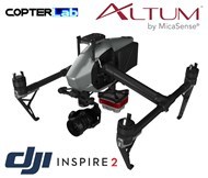
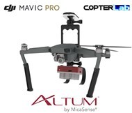
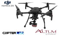
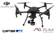
Since 2013 - 950 Gimbal Models - Worldwide Shipping - Live Support

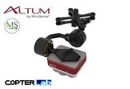
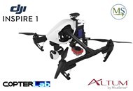
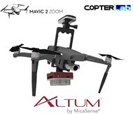
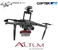
Micasense Altum NDVI Integration Mount Kit for DJI Mavic Air 2
Micasense Altum
Micasense Altum – the latest sensor from Micasense has set a new benchmark in agricultural drone technology. Now you can simultaneously capture thermal imagery as well as high resolution multispectral data. The resolution of the RedEdge M at 80m AGL set an industry standard, you can now fly higher with the Altum and get the same resolution. This means you have a bigger “swath” or effectively less overlap and more area covered per flight. Five high-resolution lenses mean you get detailed plant health imagery (4 cm GSD) and detailed Digital Surface Models all from 120m.
Altum integrates a radiometric thermal camera with five high-resolution narrow bands, producing advanced thermal, multispectral and high-resolution imagery all in one flight for advanced analytics.
A plug and play integration right out of the box, Altum is available with the DJI SkyPort, enabling seamless integration with the DJI Matrice 200 series professional drones. The price for the Micasense Altum with Skyport is $23,000 inc GST.
As with the Micasense Rededge M, the Altum includes MicaSense’s five-band configuration of multispectral bands. These bands are: red, green, blue, near-infrared and red-edge and also includes an integrated FLIR thermal sensor. This provides temperature measurement for every pixel of data collected for crop health optimization. You can process data from the Micasense Altum with industry standard software like Agisoft, Pix4D or Solvi to generate an aligned, radiometrically and calibrated six band geotiff.
Micasense Altum Specifications:
| Weight: | Altum + DLS 2: 406.5 g Altum: 357 g DLS2: 49 g Wi-Fi Adapter: 2 g USB stick: 9 g |
| Dimensions: | 8.2 cm x 6.7 cm x 6.45 cm |
| External Power: | 4.9 – 25.2 V |
| Power Input: | 5.5/7.0/10W (standby, average, peak) |
| Spectral Bands: | Blue, Green, Red, Red Edge, Near Infrared (NIR) |
| RGB Color Output: | High-resolution, global shutter, aligned with all bands |
| Thermal: | LWIR thermal infrared 8-14um. Radiometrically calibrated |
| Sensor Resolution: | 2064 x 1544 (3.2 MP per EO band) at 120m (AGL 81cm per pixel (thermal) at 120m |
| Capture Rate: | 1 capture per second (all bands), 12-bit RAW |
| Interfaces: | Aircraft: Trigger input, top of frame out, 1 PPS out. 3.3V isolated IO 2x USB 3.0 SuperSpeed ports for WiFi or Ethernet and USB 3.0 Storage |
| Field of View: | 48° x 37° (multispectral) 57° x 44° (thermal) |
| Focal Length: | 8 mm (multispectral) 1.77 mm (thermal) |
| Storage: | USB 3.0 compatible storage devices |
Altum kit comes with: Micasense Altum sensor, lens cover, external storage device (USB 3.0) – 128 GB, calibrated reflectance panel. Also a new DLS 2 light sensor with integrated GPS, cables, mounting screws, hard carrying case.
DJI Mavic Air 2
The New DJI Mavic Air 2 takes power and portability to the next level. This drone offers amazingly new advanced features in a compact form. Intelligent shooting functions and excellent image quality put aerial masterpieces within reach. Safer, smarter flight modes enables you to up your game while fully enjoying the creative process.
With a 1/2-inch CMOS sensor, Mavic Air 2 captures impressive 48MP photos. Get ready to take your aerial content to the next level. The DJI Mavic Air 2 features SmartPhoto, which integrates scene recognition, HyperLight, and HDR into one mode for optimal results. Scene recognition optimizes different camera parameters for various scenes and supports intelligent recognition of five categories: sunset, skies, grass, snow, and trees. Professional-quality footage is effortless thanks to FocusTrack. This easy-to-use suite of intelligent tracking modes includes Active Track 3.0, Spotlight 2.0, and Point of Interest 3.0, allowing you to unleash your creativity.
Mavic Air 2 – 8K Hyperlapse
Time and Movement
Mavic Air 2 supports Hyperlapse in 8K, allowing you to warp time and space for especially stunning footage. Best of all, you can achieve this shot without complex post-processing. Choose from Free, Circle, Course Lock, and Waypoint modes, select the shooting location, and the DJI Fly app will do the rest.
Stay in the air long enough to get the perfect capture with an impressive battery life of up to 34 minutes and pull off epic, fast-paced shots with a max flight speed of 68 kph in Sport mode.
Capture cinematic video clips automatically with QuickShots mode. With just a few taps, Mavic Air 2 plans and flies a complicated aerial route for a professional-quality shot. Add music, effects, and filters with super-intuitive Story templates so you can share your masterpiece directly to social media.
OcuSync 2.0 has a video transmission distance of up to 10 km and can also deliver 1080p FHD resolution livestream directly from the drone’s camera. Enjoy more freedom for exploring and more clarity for that
perfect shot.
Manufacturing Options (available in cart):
-
Fused Deposition Modeling (FDM): Made with Carbon ABS for a lightweight and durable finish.
-
Selective Laser Sintering (SLS): Black painted finish for enhanced aesthetics and precision (additional cost and lead time apply).
-
CNC Machining (Aluminum): High-precision aluminum construction for superior durability and a premium feel (additional cost and lead time apply, slightly heavier at approximately 350g).
By purchasing from us, your order id gain access to ongoing, long-term live support.
You Didn't Find Your Gimbal?
That means we didn't work enough. Start a conversation with our technicians by chat or by contact page, they will be happy to answer you asap with the most suitable solution for your needs.
Why ordering gimbals here?
Here you won't find some chinese rebranded gimbals.
We manufacture the whole gimbal parts that means
- Motors
- Gimbal controller
- Camera mount
- Frame mount
What if i crash my Copterlab gimbal?
Each part can be replaced easily by cheap offer as we manufacture each part of the gimbals we sell
What if i'm running under issue with my Copterlab gimbal?
Our support will reply you quickly by email or live chat support. After purchasing, you stay our priority.
What if i can't find model i'm searching for?
Just contact us and we will design custom parts for free!)
I just want to get the electronic and motors gimbal parts
Just click here


